 Go up
Go up


Exploring SimplyMap Data: America’s Historic Homes
Posted on Jan 07, 2015 by Admin
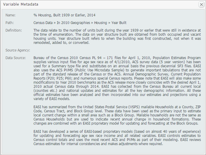
In this week’s exploration of SimplyMap data, we set out to find which cities in the United States have the highest percentage of older houses. To determine this, we used the variable “% Housing, Built 1939 or Earlier”. The metadata for this variable is shown below:
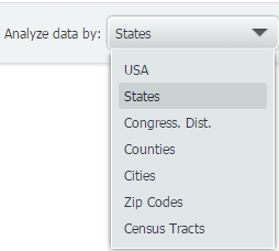
The ranking report allows SimplyMap users to analyze the data by different geographies. For example, if you select the United States as your location, you may rank the data by: USA, States, Congressional Districts, Counties, Cities, ZIP Codes, and Census Tracts.
First, we’ll take a look at the top 10 states. For reference, 12.71% of all of the housing stock in the USA was built before 1939.
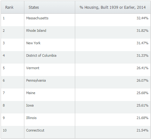
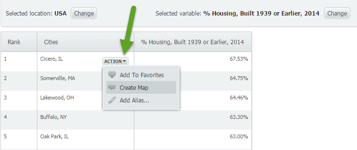
Not surprisingly, the majority of the states with the highest percentage of older homes are located in the northeast. When we switched to cities and applied a population filter > 50,000 we were left with the following cities:
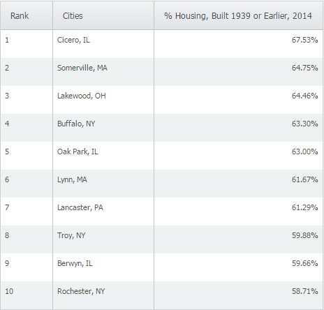
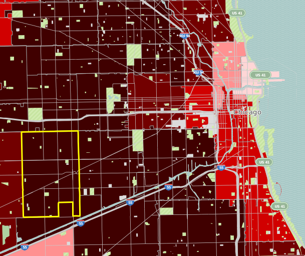
At 67.53% of homes built in 1939 or earlier, Cicero, IL ranks first among cities with populations greater than 50,000 in the United States. We then used the feature to make a map directly from the results page by hovering over Cicero, IL and selecting “Create Map” from the action drop down.
It looks like Cicero, IL is located about 10 miles west from the heart of Chicago.
Want more tips and examples of SimplyMap reports? Follow us on Twitter and like us on Facebook to stay informed!
More from SimplyAnalytics


Posted on Jan 12, 2020 by Admin
Happy New Year! SimplyAnalytics will be exhibiting at the ALA Midwinter meeting, held this year at the Pennsylvania Convention Center in Philadelphia on January 24th-27th. If you attend, ...
Posted on Apr 30, 2008 by Admin
Doreen Harwood, Business Librarian from the University of Washington has developed a series of detailed tutorials on using SimplyMap. The tutorials, which are Flash-based and interactive,...
Posted on Mar 04, 2014 by Admin
March 11-15 Indianapolis, Indiana The Public Library Association is prepared for another week of events, workshops and special appearances for librarians and authors. Visit our exh...
Posted on Dec 16, 2015 by Admin
Visit the SimplyMap team at the ALA Midwinter Meeting 2016 in Boston. We will be at booth #1913 offering product demonstrations, tips & tricks, and of course Ghirardelli Chocolate! Ex...
Posted on Sep 14, 2021 by Admin
Welcome readers! Today we are excited to welcome histograms to SimplyAnalytics. We hope you enjoy this wonderful new visualization as much as we do. Let’s take a look. What is a histogram...
Posted on Jul 30, 2015 by Admin
One great feature within SimplyMap is the ability to track the same variable across multiple years. In this report, we will track the percentage of households in the US ordering items fro...
Posted on Oct 23, 2009 by Admin
SimplyMap was highlighted in the Wake County, NC Public Library Business Blog today as a valuable tool for business planning. Wake County has access to SimplyMap through NC LIVE, a statew...
Posted on Oct 02, 2015 by Admin
In this week’s SimplyMap tip, we wanted to do a quick write up reminding users about the Saved Tabs feature within SimplyMap. Did you know that SimplyMap will automatically save all of yo...
Posted on May 17, 2016 by Admin
This week’s SimplyMap report is a quick reader challenge. Can you guess what the map of the United States below is depicting? Keep in mind the legend colors - lighter is less, and darker ...
Posted on Dec 02, 2019 by Admin
Hi everybody! We’re back this week with another question from our Help Desk. This time featuring SimplyAnalytics Canada. Let’s get started! Question: How can I analyze all of the PRIZM5 s...